Previous state
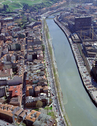
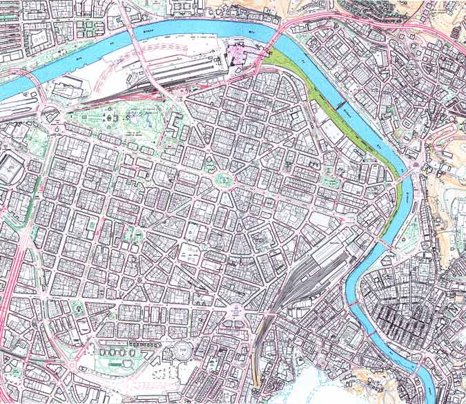
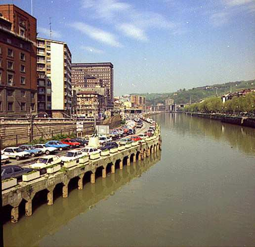
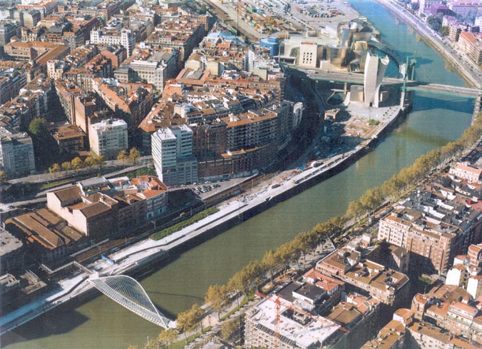
The area of Uribitarte adjoins the River Nervión and the left-hand extension of the city of Bilbao. It was once an island separated from the Abando plain by a branch of the river. After the definitive extension of the city at the end of the nineteenth century, Uribitarte ceased to be the island that it had once been geographically to become a continuous superficial extension that underwent a number of transformations over the years in keeping with the urban development of Bilbao.Prior to the intervention, it was a run-down riverside docks area with workshops and industrial warehouses. It was on a notably different level from the city extension, this being resolved only by the Uribitarte ramps that were located in an intermediate area inland from the river. The zone also carried the two tracks of the Bilbao-Santurzi railway line, and an obstructive parking area in the space between the railway track and the Nervión.
The location and the considerable longitudinal development of the Uribitarte docks clearly underlined their highly strategic value as a transitional space between the old city, the Sendeja district and the city extension, enabling links to be made between the historic parts of the city and the new urban development area of Abandoibarra, which, with its new cultural facilities – the Conference Centre, Music Centre and the Guggenheim Museum – and housing, constitutes an area that offers good possibilities for the future shaping of Bilbao's urban spaces.
Aim of the intervention
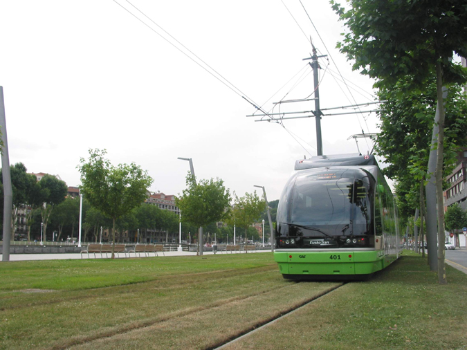
The General Town Planning Project proposed converting the Uribitarte docks area into a new public space for the city and opening up a new avenue that would link up with the area of Abandoibarra, developing it as a new line of service buildings along the river. The continuation of a recently-constructed footbridge to run through a singular building now under construction, to the Uribitarte ramps, will mean the end of an age-old separation between the city extensions constructed on the two sides of the river.The transformation of the Ribera de Uribitarte area by means of town planning included a new tramline, the first in the city for forty years, as a way of linking up the significant areas of the inner city with the different residential districts.
Description
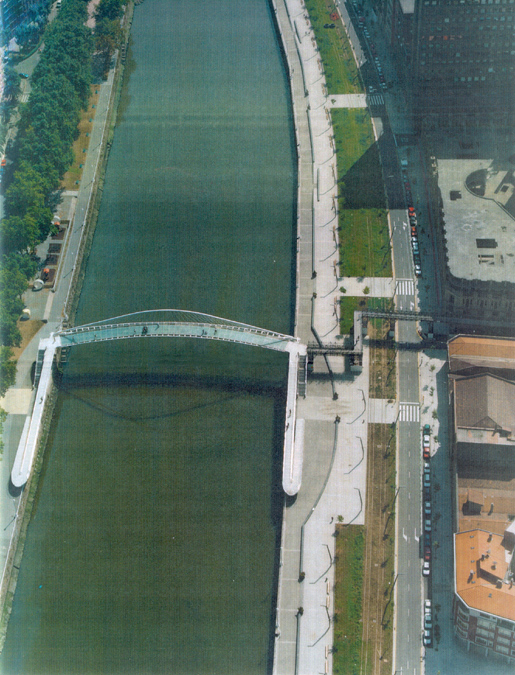
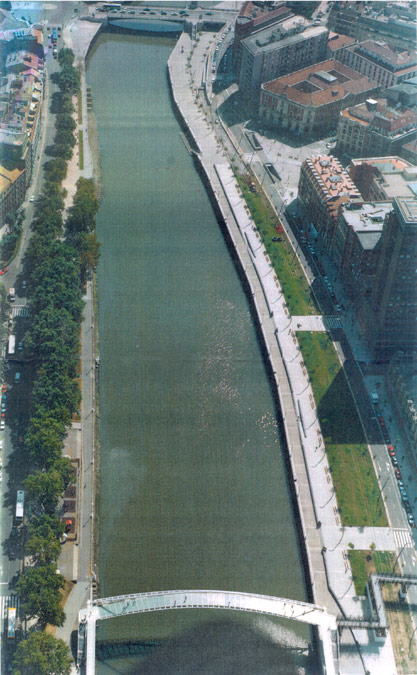
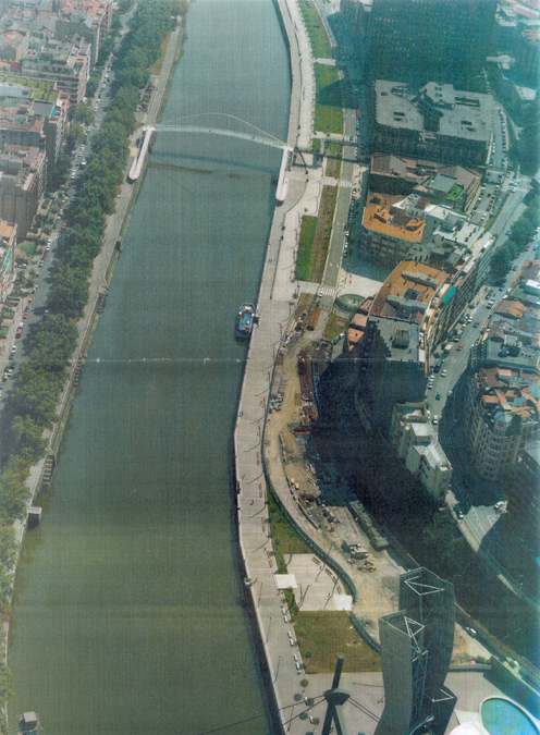
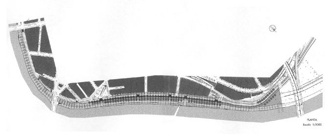
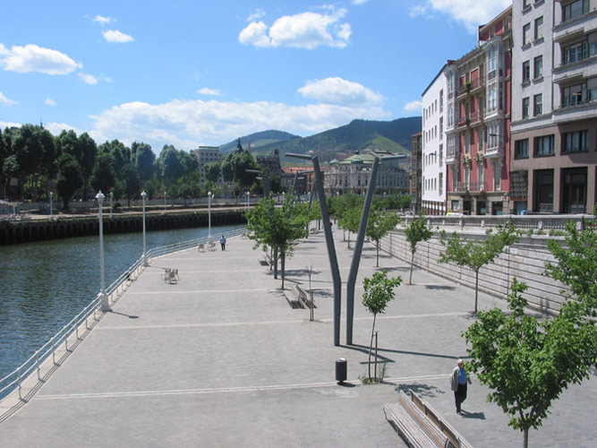
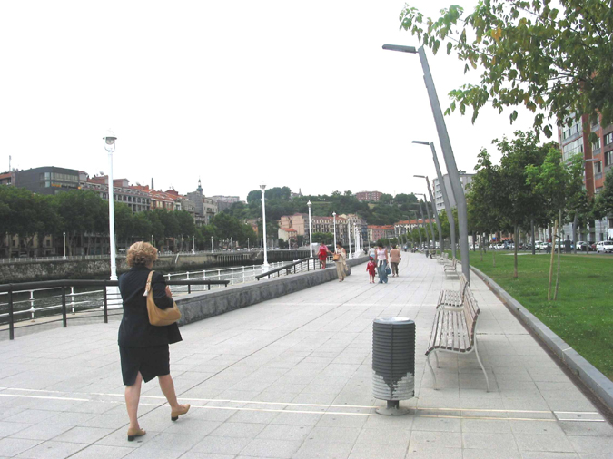
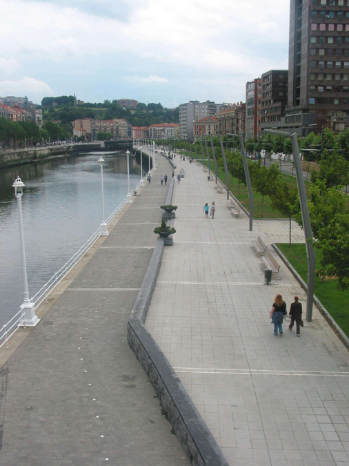
Since it was necessary to keep the railway line in operation for a certain period, the project had to be carried out in two phases. The first dealt with planning for the area between the railway lines and the river, while the second covered planning for the remaining area, including that occupied by the lines. Before work began on the site, a new main sewer was constructed to run the sewage off to the Galindo purifying plant. The European Union financed part of the project of town planning for the Ribera de Uribitarte area through its environmental Cohesion Fund. Work to recover the docks area as a green belt for public use began with the planners' opting for a set of uses for the river bank that were coherent with the traditional image of the district of Campo de Volantín on the opposite side of the river, and the historic nature of the city’s present port spaces.A river walk was formalised the entire length of the old docks development, from the left bank of the river right up to the built-up area between the La Naja district and the Guggenheim Museum. This promenade part of the project defined five clearly differentiated spaces: a docks space next to the river, a pedestrian tree-lined footpath half a metre above the docks area, a central green garden area over part of which the new tramline was to pass, a boulevard for ring-route traffic that, as a continuation of the street planned for the Andoibarra area, adopts the same character of a low-velocity thoroughfare, and a new five-metre-wide pavement going right up to the buildings in order to intensify the use of ground-floor premises that face on to the river. Work will also take into account connections with the footbridge that was constructed in recent years.
Along the perimeter of the new river walk, the docks spaces were conceived as clear platforms for strolling and leisure-time activities related with the proximity of the water. As with the walk on the other side of the river, this docks zone was treated with black granite paving stones with strips of white marble so as to differentiate it from the formal treatment given to the footpath. In order to mark this space and its changing sections, two rows of trees were planted – plane trees and box elders – on either side when the dock below permits, and otherwise there is a single row of trees marking the separation between the footpath and the tramlines. Small sets of steps and ramps are located along the walk in order to provide access between it and the docks at a lower level. The path, like the new pavement that goes up to the buildings, has been paved with an artificial hydraulic material and strips of white marble, while the edges and kerbstones are granite and limestone respectively.
Assessment
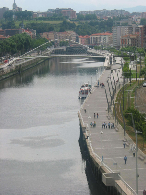
The Uribitarte docks constituted a frontier space between the urban extension and the river, without fitting into the setting. Its topographic unevenness and the effect of the railway lines created a double-barrier effect that gave a gloomy, alienated impression in terms of the relations between the land and the river, and between both banks. The construction of a footbridge represented a turning point in the dynamics of this almost autonomous area that, once it was crossed, began to gain visibility. The new path, in addition to the flow created by joining both parts of the city with the bridge, opened up the possibility of enjoying the docks area as a whole with a public space that, in its particular form, represented a first attempt to make a connection with a river façade that had traditionally ignored the markedly industrial river that was now undergoing a series of transformations with a very extensive redefinition of its uses.The river walk completes the transversal connection across the river with the new longitudinal paths at the water's edge. These promenades offer more accessibility to that already gained and they could become key elements in the configuration of a built-up river façade that is both more open to the river and more permeable to the general surroundings. The tramline intensifies still further the new links that enable the coming together of different urban geographies in a territory that has been rehabilitated for leisure-time activities of the citizens, while it is also slowly being integrated into the urban structure.
Mònica Oliveres i Guixer, architect
[Last update: 02/05/2018]