Previous state
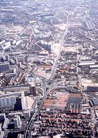
Although a minimum of two out of every three journeys in the Ile de France are from one Paris suburb to another, transport policies have fostered transport links with the capital, to the detriment of suburban areas, and failed to take into account their demographic growth and economic flows. The RN 186 highway started out as a bypass encircling the capital. However, extensive building around it, and the future opening of the A86 motorway, meant it began to lose its original function. From 1976 onwards, the development plan known as the Schéma directeur d'aménagement et d'urbanisme de la région parisienne (SDAU), established transport links between peripheral zones in spaces set aside for public transport.Aim of the intervention
This policy had already made a proviso for a transverse public transport system at the beginning of the eighties, which would link up two important points -Saint-Denis, the historic and departmental capital, and Bobigny, the administrative centre- and cross the old and new centres of La Courneuve. The system also had to provide satisfactory connections with other means of metropolitan transport, such as the arterial railways and twenty bus routes. It was predicted that the project would guarantee in the region of 55,000 users per day.The new transport scheme had to reinforce the only artery crossing the northern suburbs of Paris, the RN 186, changing it from an arterial road into an intermunicipal communications thoroughfare.
It soon became apparent that the tram was an effective means of transport which would ensure, more than others, a good level of service, profitability and economy on fuel, and also integrate well into the environment through the absence of pollution and noise. Above all, the tramline would link up the zone it ran through and enable it to become fully integrated into the urban weave whilst at the same time giving it new value.
Description
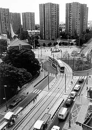
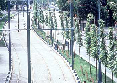
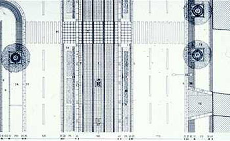
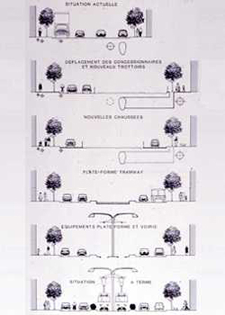
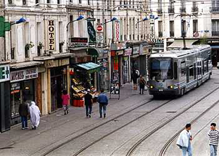
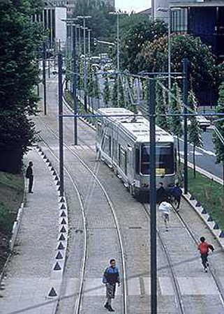
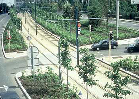
The tramline runs on more than five km of the RN 186 highway and goes along departmental and municipal thoroughfares for the rest of its route. The tram passes through four municipalities: Saint-Denis, La Courneuve, Drancy and Bobigny. It has clearly changed the function of the existing roadway by adopting a new section which prioritises space and the tram to the detriment of the car, and also sets aside areas for pedestrians.The landscaping of the infrastructure was fundamental to the project. This task was based on establishing a coherent and continuous system, which the architects and landscape architects working on the project called "the three lines": the treatment of land, which uses conventional materials and elements used in land development in order to separate uses; the planting of trees in a linear layout; and the range of street furniture specially designed for the tram system. Wide areas were pedestrianised along some sections of the route and the system also brought out of isolation the large "4000" complex at La Courneuve: a subsidised housing programme built in the sixties.
Assessment
After 54 years absence, the tram is once again running on the outskirts of Paris. It cost four times less to build than a metro line and its location in a reserved area and ability to link up districts and sectors which had been forgotten and scattered until now, make it an excellent means of transport in a heavily built-up zone such as Seine Saint-Denis. Furthermore, the predictions regarding the number of users have been met, but, more importantly, the tram has proved that a transport infrastructure can be an efficient means of increasing the value of the urban environment. The tram system has made into a reality the first, true grand boulevard in the northern periphery of Paris.[Last update: 02/05/2018]