
Previous state
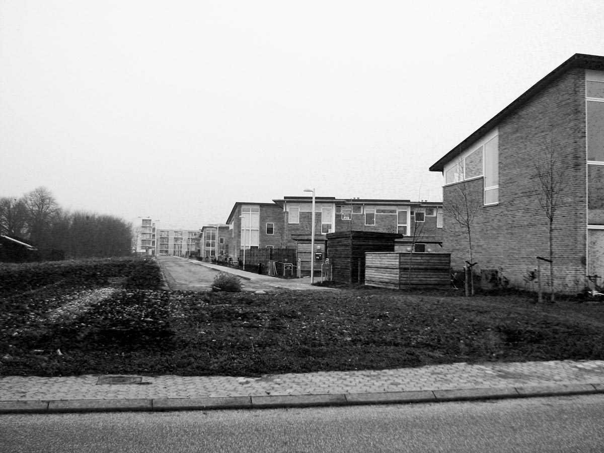
The Fingerplanen (Finger Plan) is an urban development strategy that has been a blueprint for the growth of the Great Copenhagen metropolitan area since 1947. The Plan resembles the shape of an open hand, whose palm would represent the dense, compact structure of the core of the city, while the fingers would correspond to the five lines of the railway system (S-Bahn) which connect the different suburbs of a disperse periphery. One of these suburbs, corresponding to the thumb of the Fingerplanen, is the municipality of Vallensbæk, some fifteen kilometres to the west of the city centre.This thumb happens to cross the old centre (Vallensbæk Strand), which hosts the original village, the railway station and a medieval church, leaving on either side two zones of more recent development. While the southern part (Vallensbæk Landsby), a well-consolidated area which is in contact with the beach, enjoys a good standard of living, the northern zone (Vallensbæk Nordmark) is of a more fragmentary and marginal character. In the middle of this zone of messy urban planning, an ambiguous barren strip of some fifteen metres wide ran from north to south along the more than three hundred metres separating Kloevervaenget and Blomsterengen streets. This unused space was the result of a badly resolved meeting between two very different kinds of urban fabric, one consisting of small middle-class terrace houses and the other of 225 units of social housing accommodation occupied by workers and immigrants. Not far from these two sections are a copse of trees and a large field, odd survivors of real-estate expansion.
Aim of the intervention
In 2005 the Vallensbæk Town Council conceived of a strategy named Torvevej (Route of Squares), in an attempt to link together the three parts of the municipality by means of a sequence of interconnected public spaces. One of these was the unused strip in the northern sector, which was incorporated into an urban plan with the idea that some day it could be used to compensate for the absence of meeting places in the neighbourhood. The formal heterogeneity of the adjoining spaces and the social and economic diversity of their inhabitants gave rise to the idea that, once it was transformed, the space could fulfil the function of a suture and foster interaction among strangers. Five years later, the Council had achieved a fund of almost half a million euros to finance the work required by the project.Description
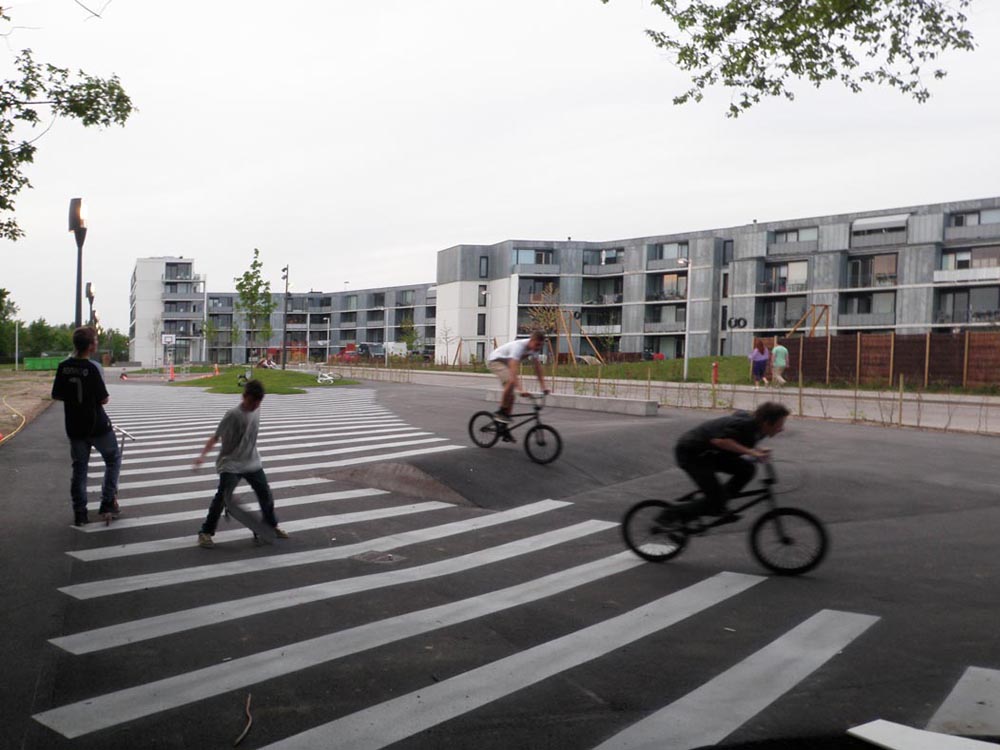
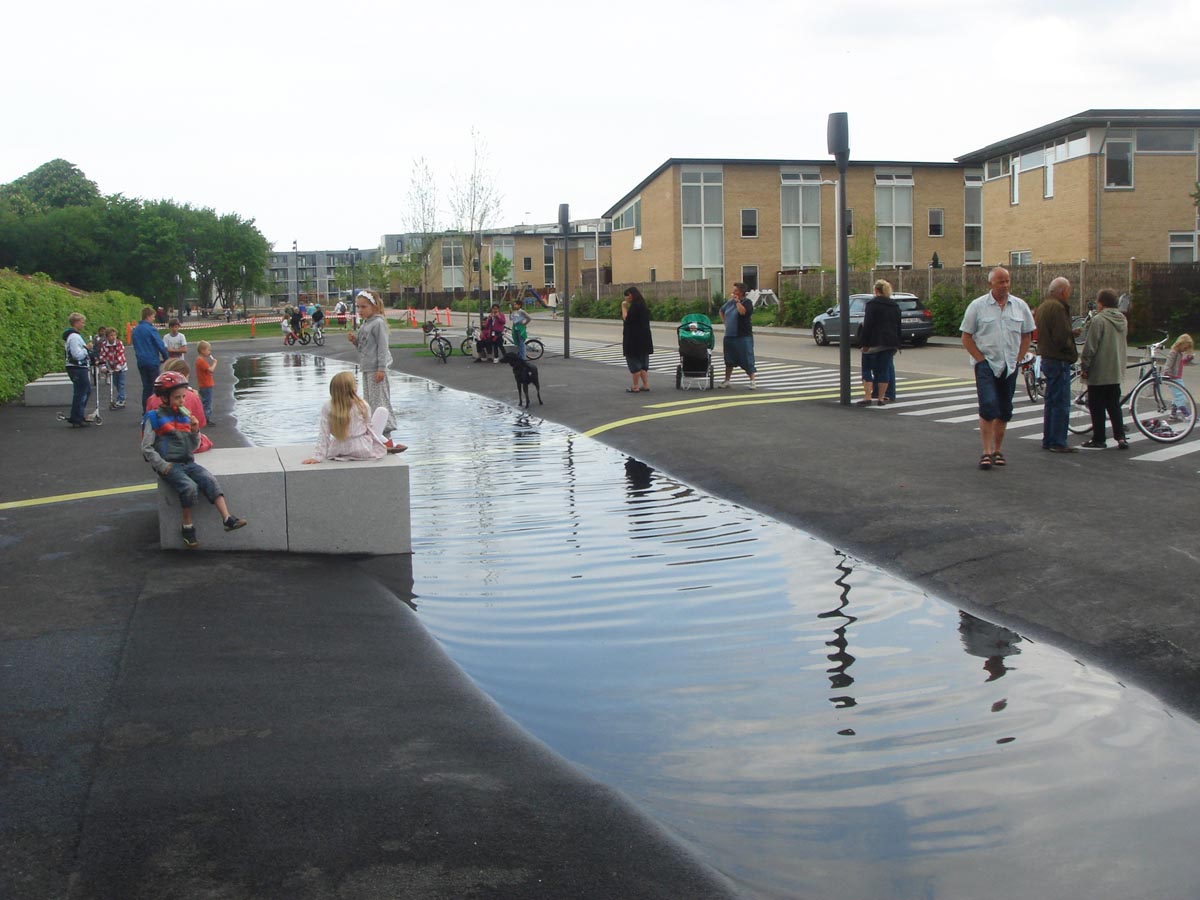
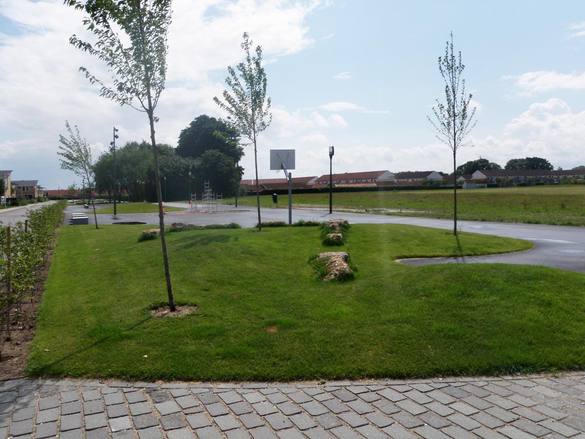
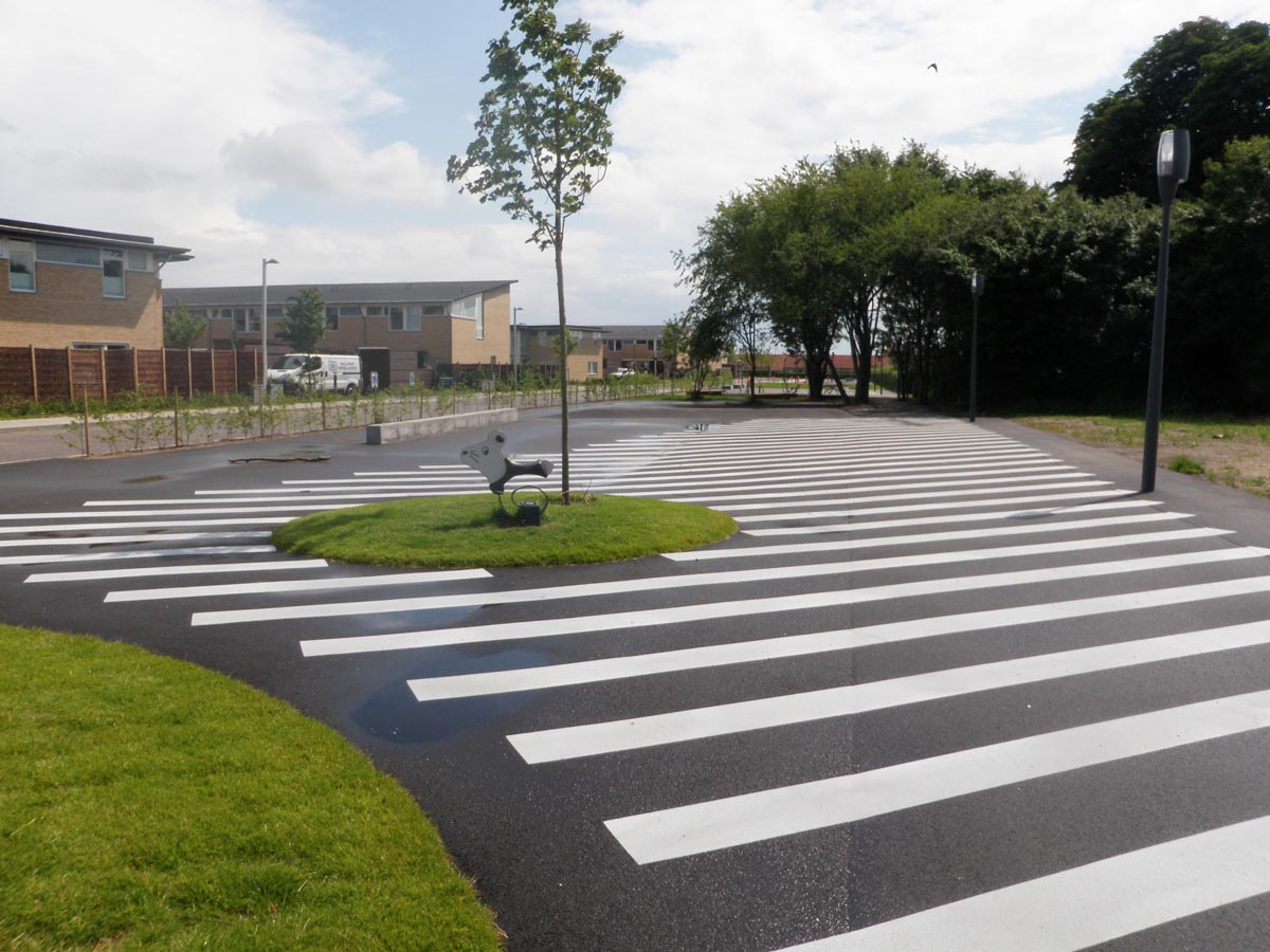
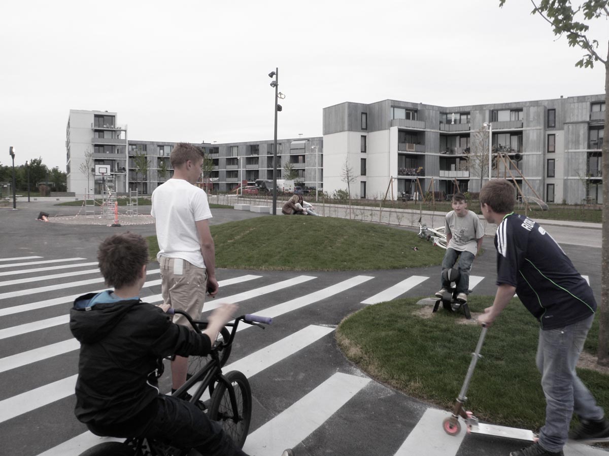
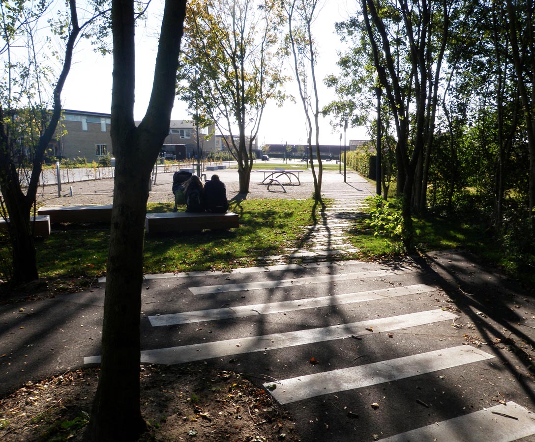
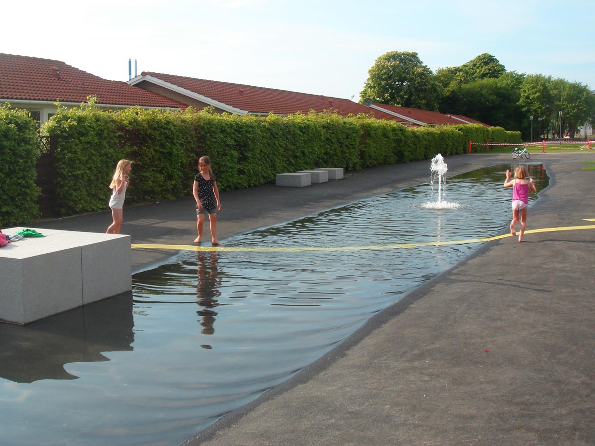
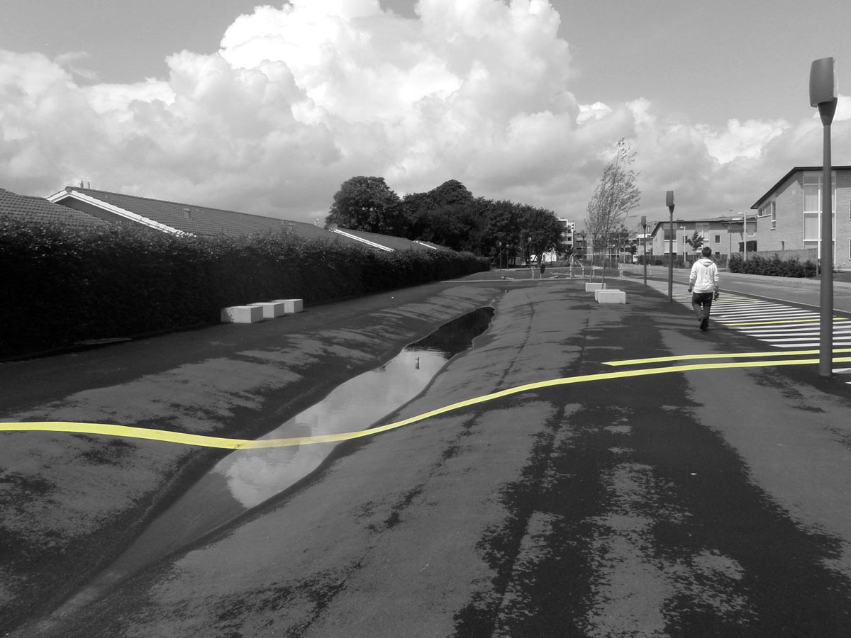
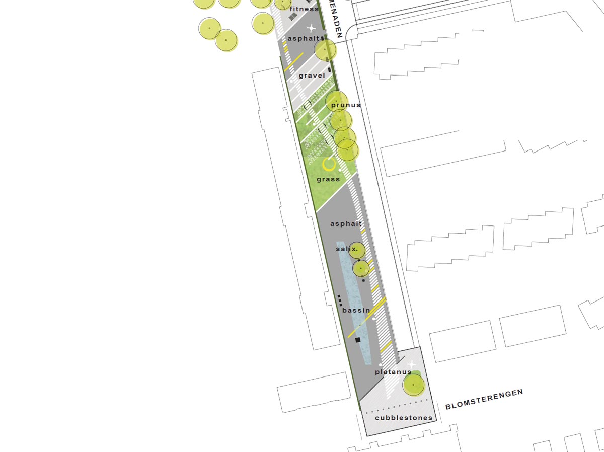
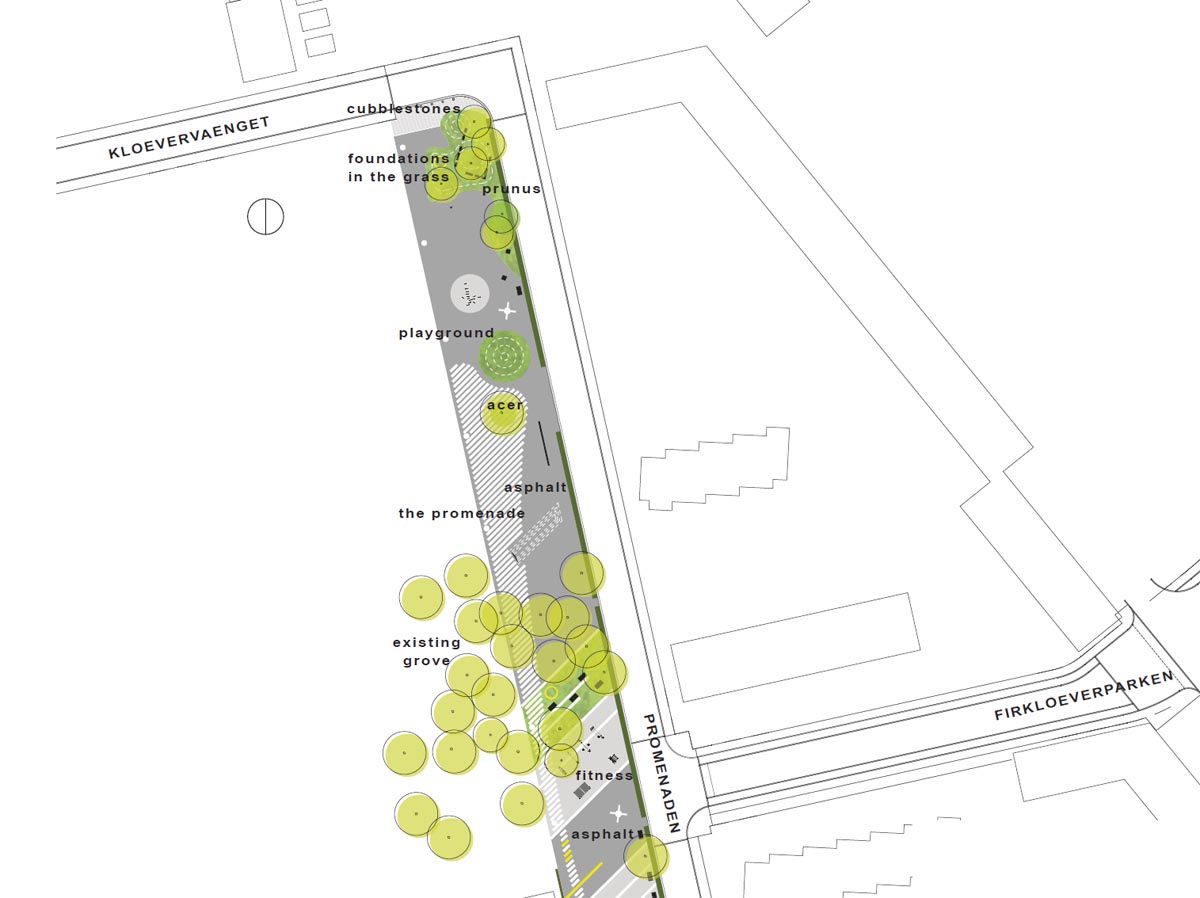
Another year later, the previously unused strip of land had been transformed into a promenade with gardens for pedestrians and cyclists. The earthmoving work carried out as part of the project revealed the foundations of an old farm and garden to which the trees of the pre-existing grove had belonged. This thicket was conserved and now shelters tables and benches for picnics. In addition, its volume counters the excessive linearity of the site by dividing its three hundred metres into two distinctive parts.The southern section, which has a channel of water running through a good part of it, is made up of a series of sections of different textures, for example grass, gravel, asphalt or paving. Solid stone block benches have been introduced in some places. The end nearer to the forest has been furnished with physical fitness equipment for open-air exercise and, next to it, three sandy areas are an invitation to play petanque. In the northern section, next to the large field, the texture is harder and the mainly asphalt surface is good for skating, bike riding, skateboarding, and playing basketball around a goal post installed with this in mind. Here, there are only four patches with a softer surface, three of which are circular and contain grassy mounds or children’s play equipment. The fourth one, of more irregular profile, outlines the remains of the old farmhouse.
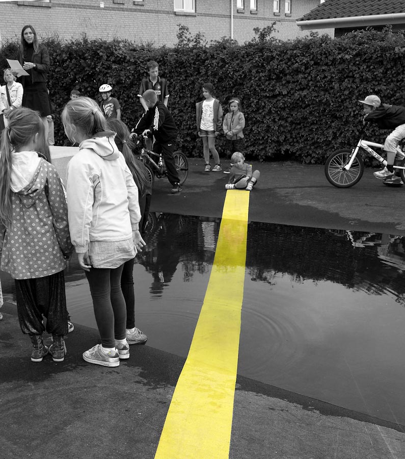
A pattern of parallel lines reminiscent of a zebra crossing traces a path that organises the whole promenade from one end to the other. The constancy of its striped motif brings an iconic charge to the longitudinal pedestrian route, endowing the space with uniformity. However, the path responds to the heterogeneity of the sections it passes through by varying in width, direction or materials. Although its sections are painted when the surface is of asphalt, the stripes are made of metal when they cross the softer surfaces of gravel or grass and even water. In effect, one of the segments escapes from the path to form a delicate footbridge over the sheet of water. Newly-planted cherry trees, willows and plane trees line the path.
Assessment
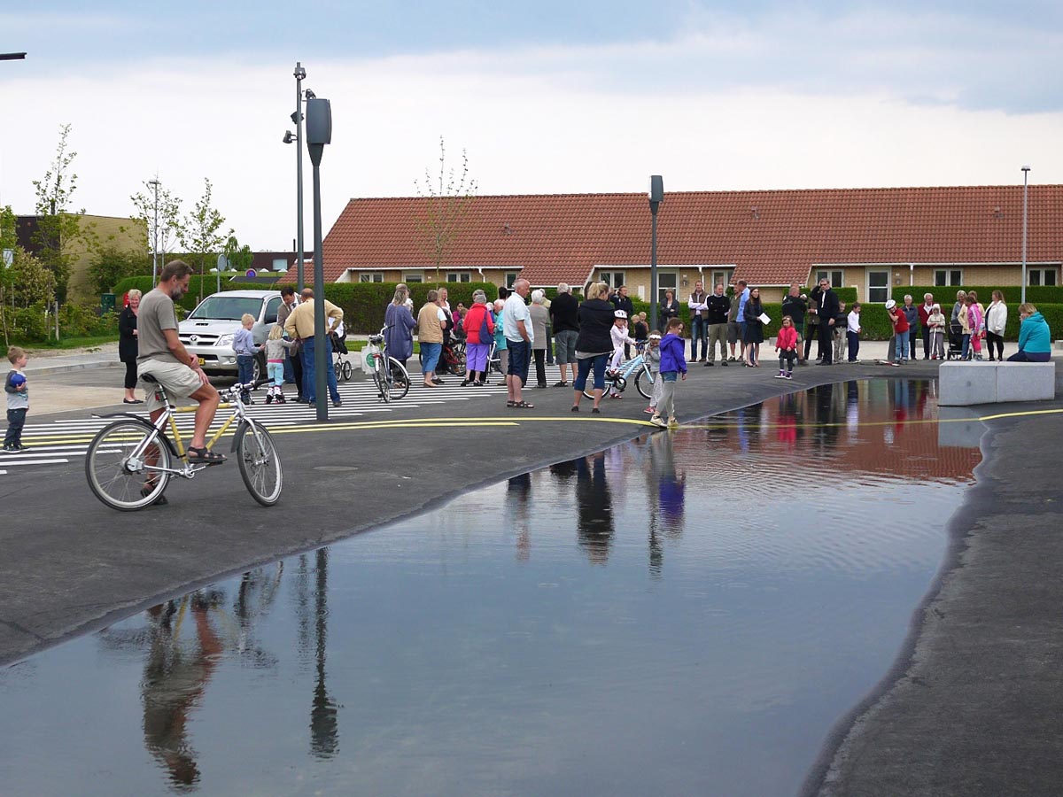
The new promenade is a public space that is cohesive in two ways. First, it has founded a place for people to stay, a meeting point for residents of different ages, origins and social conditions who have discovered the collective identity of their neighbourhood. It has achieved this by means of a design that is informal, cheerful and attentive to the many uses it might offer to local residents. Also, thanks to the distinguishing mark bestowed by the image of its “zebra crossing”, which contrasts with the dullness of a road network that lacks any kind of special attribute. Moreover, it has made the most of the discovery of the old farm by incorporating it as a historical element in a suburb where everything is too new. Second, the promenade is a space of movement that opens up a once disorganised and fragmentary section of urban fabric, of piecemeal structure imposed by the interests of private profit, and lacking public spaces to structure the zone. Furthermore, far from being limited to stitching together local fragments, the project contributes towards the large-scale strategy to improve the connection of rest of Vallensbæk.David Bravo Bordas, architect.
[Last update: 02/05/2018]