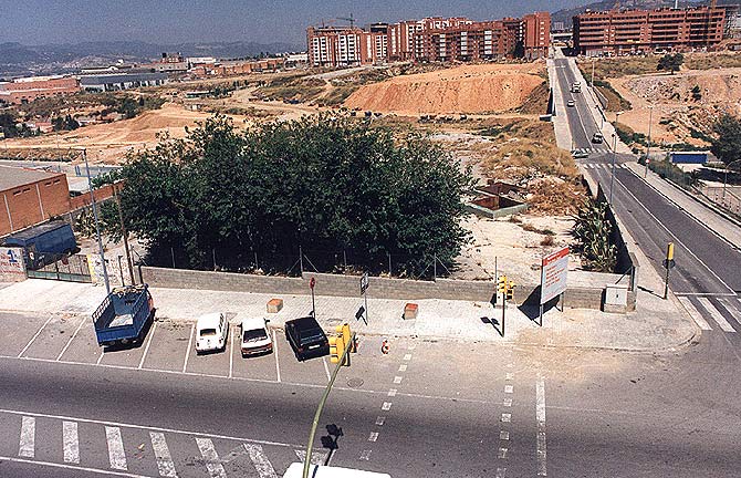
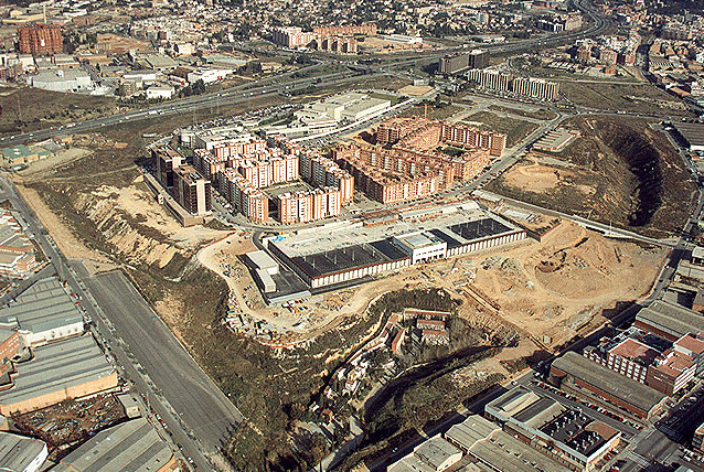
Previous state
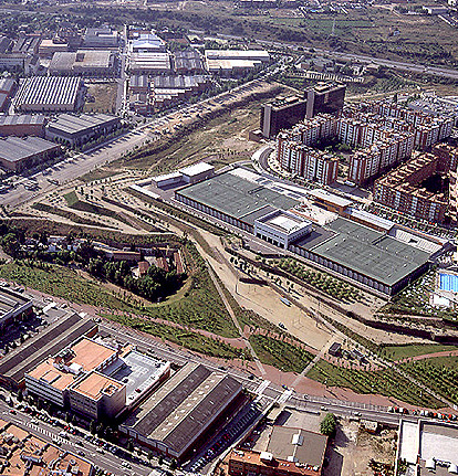
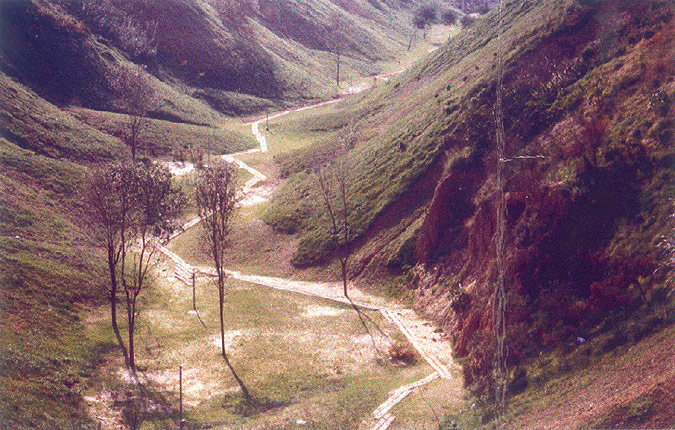
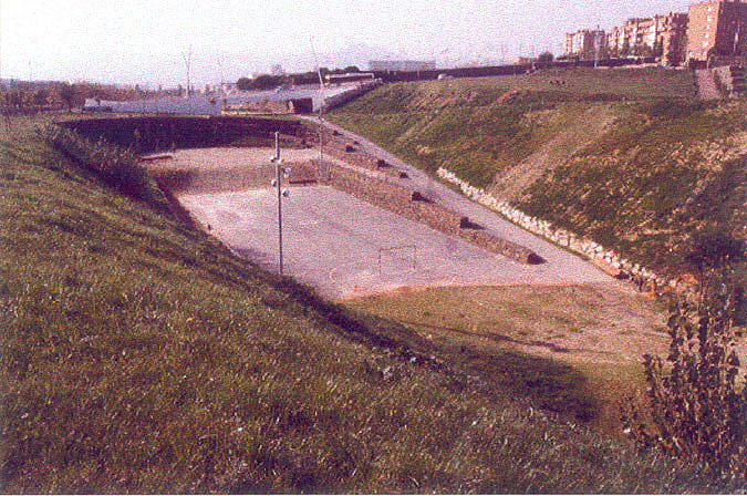
The dry Fontsanta streambed in the municipal area of Sant Joan Despí, in the Metropolitan Area of Barcelona, was channelled years ago and used for a long period as an open-air rubbish tip for inorganic waste, this fact producing considerable changes in its form while also eliminating a natural system with all the processes involved. Prior to the project, the former stream had undergone different degrees of transformation. In its surrounds, the area between the cemetery and a sporting area installed on the top of a large water tank had been completely levelled, while the zone to be developed in the project's fourth phase – constructing a park – conserved, to a great extent, the form and topography of the surroundings of the old watercourse.Aim of the intervention
In the Mediterranean area, the characteristic presence of streams has notably marked the morphology of the region. Despite this fact, however, these streams and their spheres of influence have frequently been regarded as places that are not part of city life, that do not lend themselves to having their main uses incorporated, so that they are frequently classified in urban planning as green areas to be developed in some future. The Metropolitan Area of Barcelona called for tenders for the construction of a park that, named after the old stream running through the site, would bring it meaning, giving it sense on the local and supralocal scales. The Fontsanta Park, constructed in different phases following the tender, and situated between an industrial zone and a residential area constructed relatively recently, aimed at rectifying this situation of exclusion and the growing precariousness of the place in converting it into a green zone where the landscape would once again become a true point of reference.Description
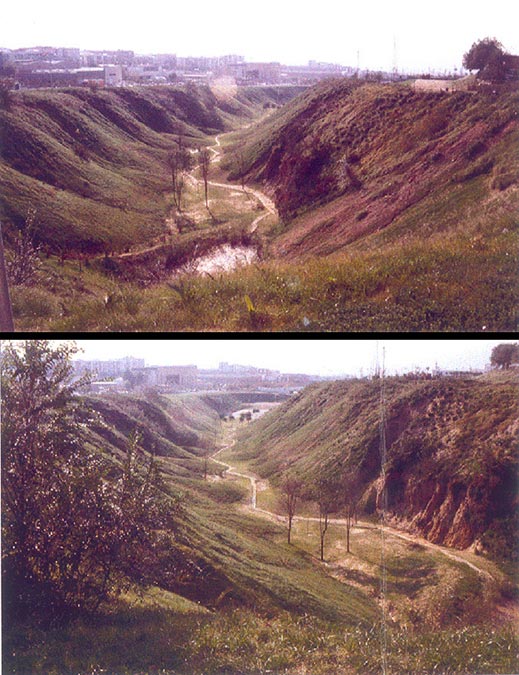
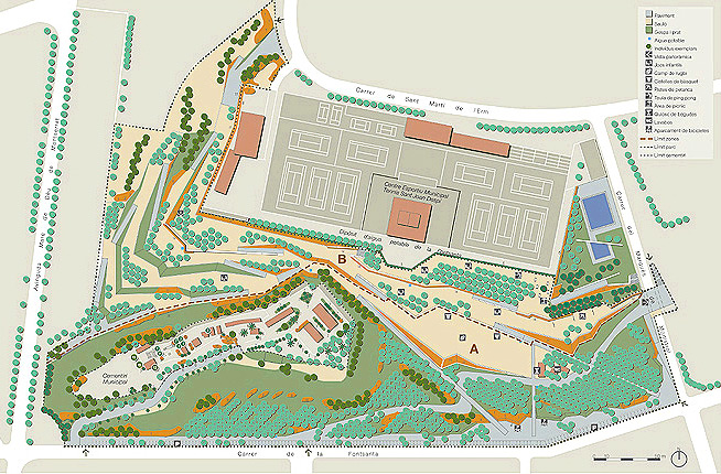
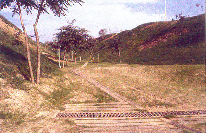
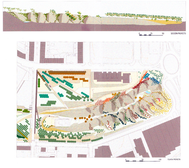
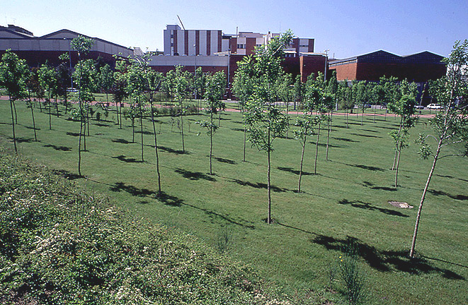
In its different phases of execution, the park represents a set of new public spaces for the city. The fourth phase of the project, involving an area of 3.5 hectares, will be carried out in an zone where the original morphology and topography, with differences in levels of up to thirty metres, are conserved with very few changes. The project envisages an intervention that reconstructs the site through the memory of its previous states, using elements appropriate to its landscape. The two basic features in the basic formation of the park, in this phase, were the gabion terraces, that have been used to resolve the differences in levels and to give shape to the areas of intensive use, and the forest of maple and ash trees. These elements were brought together to create a whole that would give continuity to a space that has relevance on both metropolitan and regional scales.The system for moving around the park is organised on the basis of its topographic conditions. From the upper levels, which are linked with the different streets of their surroundings, but basically starting from a point that joins them with the neighbouring residential area, a flat, slightly sloping zone has been created, from which slow descent is possible through the lower paths to the centre of the former watercourse at the bottom of a gully. From here, along a path flanked by banks of earth, one reaches a new sports facility or a small pond at either end.
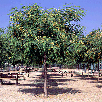
New ground has been added to the earth embankments in order to stabilise the effects of the old tip, creating a formal structure that is markedly new and reinforcing the steep natural slopes of the former watercourse. The work has been done so that, without trying to achieve a construction that obstinately adheres to the original site, it does have the effect that the memory of its previous stages – as a stream and as a rubbish tip – has suggested the mechanisms guiding the intervention. Thus the action of tipping the new earth in order to reinforce the ground can be inferred in the treatment and disposition of new vegetation that descends down the banks from the upper platforms, following the envisaged courses of maximum water erosion, to end up in rich profusion in the bottom part of the bed of the former stream, the absence of which suggested a zigzagging path for walkers that somehow reinterprets the presence of the old watercourse through a naturalised sequence of cones of earth in the gully. Pre-existing vegetable species of the zone were used in the newly-planted areas (elms, broom, mimosa), along with watercourse vegetation (locust tree and ailanthus), climbing plants, along with fields of grass for fixing the soil and avoiding erosion.
Assessment
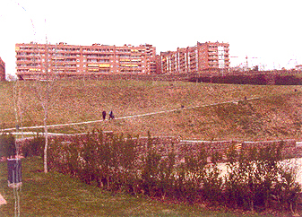
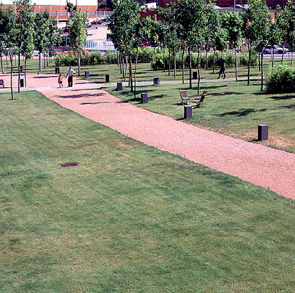
The new park is the fruit of careful attention being given to the natural conditions of a site that has been regenerated on the basis of its previous vicissitudes. The project proposes a number of natural itineraries through the newly consolidated surroundings, which, with their formal contrasts, reinterpret the space and bring out its history. Thus, the rectilinear lines of the paths from the upper levels that are connected with the urban surroundings seem, with their evident sense of direction, to draw the walker into the mysterious world at the bottom of the gully, where the small track that gently runs between the high walls of its banks provides a contrast, in its fragmented nature, with the form of the upper paths. The sudden changes in views along the lower track are an invitation to remove oneself from the urban surroundings and to penetrate the secret and recondite atmosphere of a place that, in good measure, has been restored by this project to its natural state.The small pond at one end at the bed of the former watercourse accentuates the feeling of a general allusion to the memory of the place and its former states, offering a homage to the absent water, once the protagonist of the zone and essentially responsible for its characteristic morphology. The construction of the Fontsanta Park represents a major environmental improvement for all of the immediate urban surroundings in the transformation of a peripheral zone endangered by misuse and neglect into a naturalised area for purposes of relaxation and recreation.
Mònica Oliveres i Guixer, architect
[Last update: 02/05/2018]